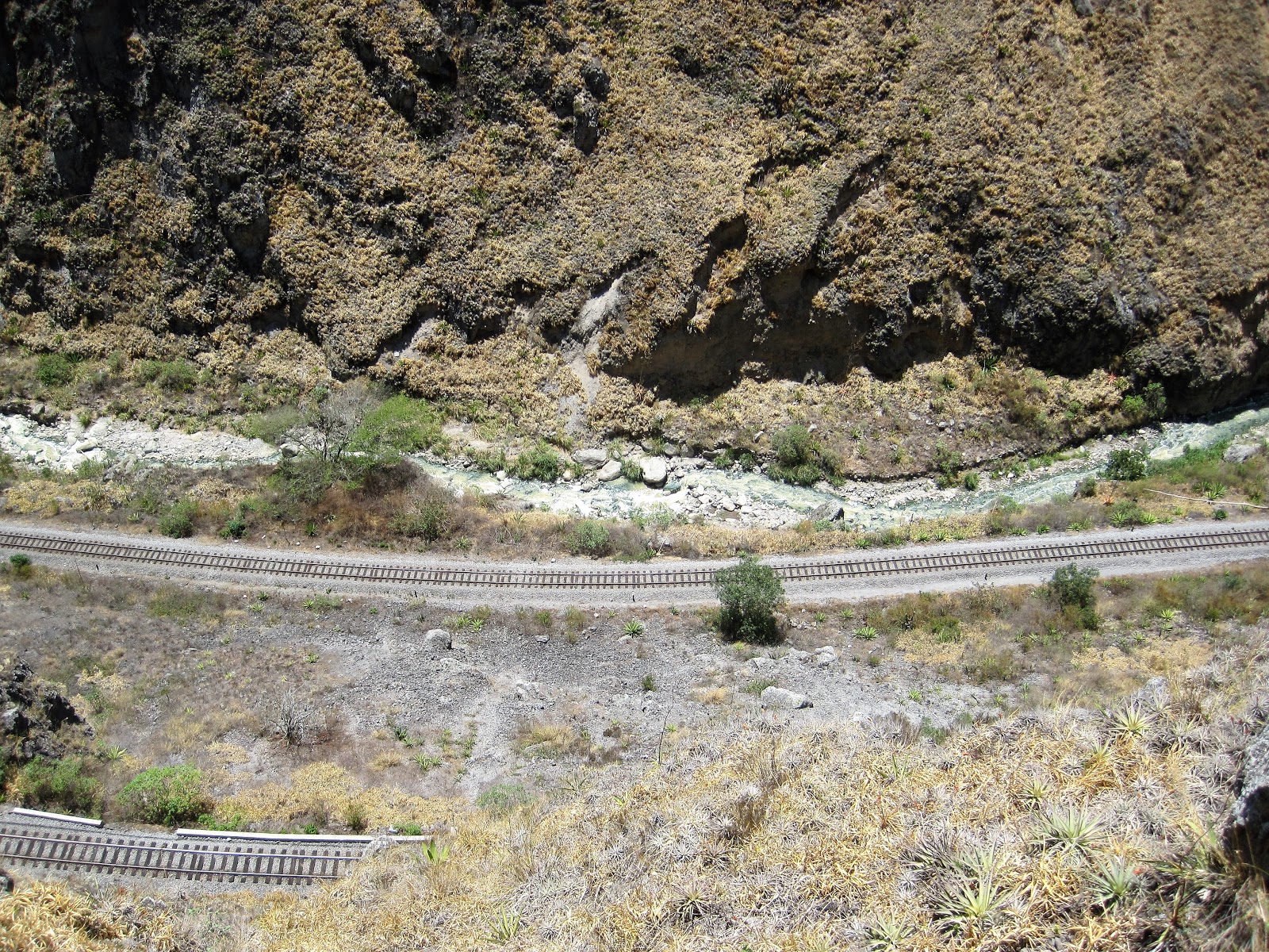
From Montanito we headed inland to the mountains and the small town of Alausi. In 1895, the President of the Republic of Ecuador announced that a new railroad would be built to connect the coastal city of Guayaquill with the capital, Quito, in the highlands. Due to frequent earthquakes, heavy rains, wildlife (jaguars and poisonous snakes), malaria and yellow fever, building of the railway was not an easy task. Add into the mix the change in altitude from sea level to 2,800m and a massive lump of pure rock known as the Devil's Nose (Nariz del Diablo) meant that engineers needed to devise a series of steep curves and switchbacks where the train shunts back and forth therefore allowing it to climb the 1-18 gradient. The trainline operated until 1997 when a number of landslides devastated the tracks, closing the entire line. Now, there is a stretch that is open for tours and the views were amazing

The devil's nose


From Alausi we headed south in the highlands to the city of Cuenca. It is known as the most European city in Ecuador as it has many 16th and 17th century Spanish colonial architecture. The historical centre is also listed as a UNESCO World Heritage site


On the Sunday we decided to walk up to the lookout

Almost 600 steps later and out of breath, we reached the top (still at 2,550m). The view of the city below was well worth it

All this walking at altitude is standing us in good stead for when we get to Peru.


Almost 600 steps later and out of breath, we reached the top (still at 2,550m). The view of the city below was well worth it

From Cuenca we drove down and crossed into Peru and spent the night at the coastal town of Mancora. Along the way we passed many shanty towns and the poorest areas of Central and South America that we've seen so far. From the coast we headed inland, had an overnight in the town of Olmos where election fever had gripped the locals and so making it an incredibly noisy night, then into the Amazon region and the mountains once more. We spent the afternoon hiking to Gocta Falls, the third largest in Peru with a height of 770m. Unfortunately the weather had started closing in so we didn't get to see the landscape and falls at its best, but we got to work the legs and lungs once more.


Wet and cold, we arrived in the town of Chachapoyas only to find election fever was there too. This town was just another overnighter to enable us to get to the tiny town of Nuevo Tingo the following day to visit the archaeological site of Kuelap, also known as the Machu Picchu of the north. No election fever here, instead we were awoken to the noise of a braying donkey that sounded like he was being sawn in half. There is a cable car to the top that would normally take 20 minutes but this was closed for maintenance. Instead we drove up the winding mountain road that took almost an hour and a half. At the top we had to walk about 2kms up stone steps to the ruins. The view of the mountains below was worth it, even before we got to the ruins, and yes that is the road we drove around.


After all the walking and hiking that we've done at altitude lately, this wasn't that strenuous.
The drive from Nuevo Tingo, via Cajamarca to the coast was very tiring two days for Mark. Single lane dirt roads with potholes and ruts, and no barriers with vertical dropoffs were quite scary. I'm glad we were up in the clouds for some of it so I couldn't see the sheer cliffs. At one point a sign read 3.600m and I could see the top of the mountain range at the same level on the other side of the valley. This is one of the roads we drove up


Now it's time to head down to the capital, Lima
No comments:
Post a Comment