Saturday, 24 November 2018

Bolivia

The small town of Copacabana is on the shores of Lake Titicaca.


At an altitude of over 3,800m/ 12,500ft, the lake is the world's highest navigable body of water and is 190kms/118miles long by 80kms/50 miles wide and is said to be the birthplace of the Incas. It is also incredibly deep with a maximum depth of 284m/932ft. We took a boat out to the "Floating islands", man-made islands made from thick buoyant reeds by the Uros people. According to legend, the Uru people migrated from the Amazon to the lake area but were oppressed by the local population so built the reed islands so they could be moved into deep water for greater safety.


From Copacabana, we headed to La Paz. The main highway crosses the Strait of Tiquina, separating the big lake from the little lake. The only way across is by ferry which are more like barges. Busses and trucks cross this way too, although the barge we were on needed a bit more attention


We left the car in La Paz and took the overnight bus with sleeper seats to Uyuni (10 hours in which Mark slept most of the way) and joined a 3 day/2 night tour of the salt flats (Salar de Uyuni) and surrounding area. Unfortunately it was Mark's turn to be unwell thanks to a bout of food poisoning from lunch in La Paz, so he didn't really see much of day one. I, on the other hand, took the opportunity to see as much of the area as I could. Salar de Uyuni is the world's largest salt flats at 11,000 sq km compared with Bonneville in the US which is just over 103 sq kms. January 2019 is the fifth year that the Dakar will cross Bolivia.


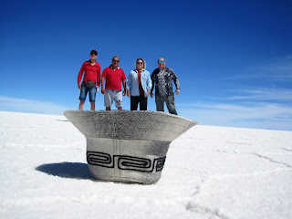
some trick shots our driver took


 the other three passengers - the boys from Brazil in Fabio's hat

The flats

Incahuasi - an 'island' in the middle of the salt flats where the strange cacti grow


I had a very peaceful walk around the island


Day 2 on the road again into Eduardo Avaroa Andean Fauna National Reserve


Arbol de Piedra, or "stone tree"


No wonder we were out of breath


Day 3 - up at 4am to set out for the geysers at sunrise


and the thermal pools at 38C - 40C were very welcoming in the chilly 6am sunshine


Lago Blanco

 the 'world cup' and other rock formations

 a bear and a dog?

 Lago Negro


At the end of the day we caught the overnight bus from Uyuni back to La Paz. Again, we had sleeper seats but the bus stopped a few times before midnight, and the driver was heard banging bits of metal before setting off again. The last time was fatal and the bus had broken down. To be fair to the company, two other buses turned up before the lights went on and woke every one else up and we found seats and carried on sleeping until we arrived in La Paz on time at 6am. We were lucky enough to be able to check into our Airbnb apartment at 8am, have a nice hot shower and get a few hours sleep before exploring the city again for a few days. This time, the 3,650m altitude didn't seem much of a problem as it had been before.


The next day we decided to ride the various cable car lines and see the city from above

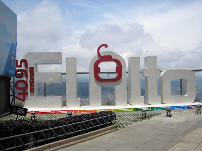
Not sure  where La Paz finished and El Alto began


It was an interesting drive out of La Paz as the steep gradient and altitude meant the car wouldn't do more than 15kph and Mark was on tenterhooks incase it stalled, but we made it out with no problems.
On our way to Chile we passed a number of volcanoes and taking photos out of the window on the move is always interesting. In fact, I couldn't have framed this shot better if I had tried.


Now we are in Chile and the adventure continues...


Thursday, 22 November 2018

Ceviche and oxygen

Everything a body needs.....

After another couple of weeks at upto 4900m in the Andes in Peru and Bolivia, we finally made it to Chile and back to the coast. We actually made it down to Arica a couple of days ago via the loneliest road we have been on - we were the only people entering Chile at the border crossing, and it still took an hour. But we didn't find anywhere there with a sea view that served good ceviche, and by the time it's slogged its way up into the mountains I just don't trust fresh ocean fish away from its natural habitat.....

This is Iquique for tonight, on south tomorrow across the Atacama to Antofagasta....

Monday, 12 November 2018

Arequipa, Colca Canyon and Puno

From Nazca we followed the coast road south then the next day headed inland to Arequipa. It was founded in 1540 by the Spanish and is Peru's second most populous city. After Peru gained its independence from Spain in 1821, Arequipa was declared the capital city from 1835 to 1883. The city is filled with baroque buildings constructed from a white volcanic stone called sillar and the historic centre was declared a UNESCO World Heritage Site in 2000. Unfortunately, an 8.4 magnitude earthquake on 23rd June 2001 damaged several of the historical buildings.


The city is framed by three volcanoes, and here is the view of Misti (last erupted in 1985) from our apartment window


From Arequipa we continued our climb to the town of Chivay (at 3,700m), the gateway to Colca Canyon. 

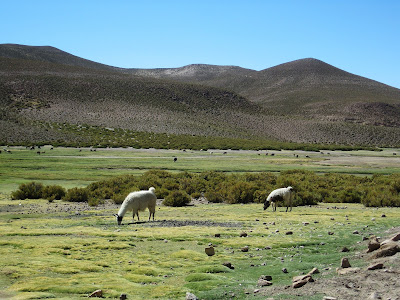
On the way we passed herds of alpacas (which are very tasty) and the shy and protected vicuna, whose wool is extremely fine, more so than cashmere. 


Chivay is a small town and the last earthquake in 2016 caused damage to a number of buildings


and this one in the central park just made me smile


The canyon has a green valley with terraced agriculture that pre-dates the Incas.

 0

To the west, Andean condors circle above the Cruz del Condor lookout. We saw about six or seven during the time we were there (or might have been the same two flying back and forth) 


We then headed to Puno on Lake Titicaca. Not a very memorable place but it is known for it folk festivals and colourful dancers. We happened to see a parade with lots of dancers in the main square that evening.


Now that's it for Peru. The next day we crossed the border into Bolivia and are now in Copacabana on Lake Titicaca (but that's another blog)