Sunday, 31 August 2014

Dinner AND a show


Went out to Chana hot springs after supper last night, which is about 60 miles out of Fairbanks, and open until midnight. Water was at 102 degrees and car dash was showing 25 while we were driving up there, so a nice contrast of temperatures when you moved in and out of the water. And as we had hoped and planned by coming up to alaska this late in the season the aurora is starting to show a little activity. We saw some bands across the sky while we were in the springs between the clouds of steam - not as bright as these google image photos, but they give the general idea of what we saw. I would describe them as bands or ribbons that appear and fade over a course of a few seconds to a couple of minutes, sometimes like wispy clouds, other times more definite


and then driving back slowly we stopped at a few vantage points and were rewarded with a period of more activity with them sort of dancing vertically - more like sheets of light or fire, as if there were powerful searchlights over the hill. And definitely green. 

Saturday, 30 August 2014

Did the earth move for you too?


Just experienced a 5.07 magnitude quake centred about 40 miles NW of Fairbanks at a depth of 10 miles. Sat in the bus at the campsite just before supper and everything started shaking for a few seconds. Our first thought was that someone had hit the back of the bus or the jacks had sunk, but that didn't feel quite right. Checked the earthquake news and found out it was this...

http://www.aeic.alaska.edu/Seis/recent/macsub/quakes/2014243_evid11372783/evid11372783.html

spookily enough I had just been emailing my friend Chris who was in California for the past couple of weeks with his family to see if he had been there for their recent shake.

and no, I wasn't snoring...

Friday, 29 August 2014

Autumn in Denali National Park...

... is definitely here. We're about 240 miles north of Anchorage and the leaves on the trees have a lovely hue. The colours in the park range from dark green through gold to deep reds - beautiful.


You can only drive to Mile 13 in the park without a permit. so we took a shuttle bus to Mile 66 (only took 4 hours each way) and saw caribou


Dall sheep and Grizzly bears. I was surprised at how blonde some of the bears were


Even though it was a cloudy and very chilly day, the scenery was something to behold


Apparently, 70% of visitors to Denali, including us, see this view of the highest mountain in North America, the spectacular Mount McKinley (at 20,320 ft, 6,193m)


and this is what it's supposed to look like


It can be seen from Fairbanks too, and as that's where we dead tomorrow, fingers crossed for clear skies...

Monday, 25 August 2014

A near moose

we don't often drive at night, but it was easier and cheaper to take Toad down to Valdez to do the glacier tour, and by the time we got off the boat and grabbed some supper it was getting on for dusk with 130 miles back to camp. Being paranoid I feared the worst so set the cruise control for about 50 to stop my speed creeping up and started off. And lo and behold about an hour up the road a moose came out of the woods on the right and diagonally across the road at a canter. If I'd been on dipped headlights with oncoming traffic I would not have seen it in time, and if I had been doing the speed limit of 65 I expect we would have hit it. Maria didn't even spot it until I hit the brakes - as it was we stopped in time and put the hazards on for the cars behind us until it moved off the verge. Even if I had hit it, It would never have fit in the freezer....

Sunday, 24 August 2014

Top of the World to Anchorage


As the border guards let us in, they told us that the first 9 miles of road was sealed and very good,


then it changed to a goat track with soft shoulders and a 3,000 foot drop – how right they were!


By the time we got to Chicken (named after the creek where gold was found, not the giant chicken sculpture)


both Badger and Max were caked in mud


We carried on down the mountain road to Tok and Glenallen where the scenery was spectacular


We parked up Badger and drove down to Valdez in the car (only a 3 hour drive each way!) – again the views were amazing


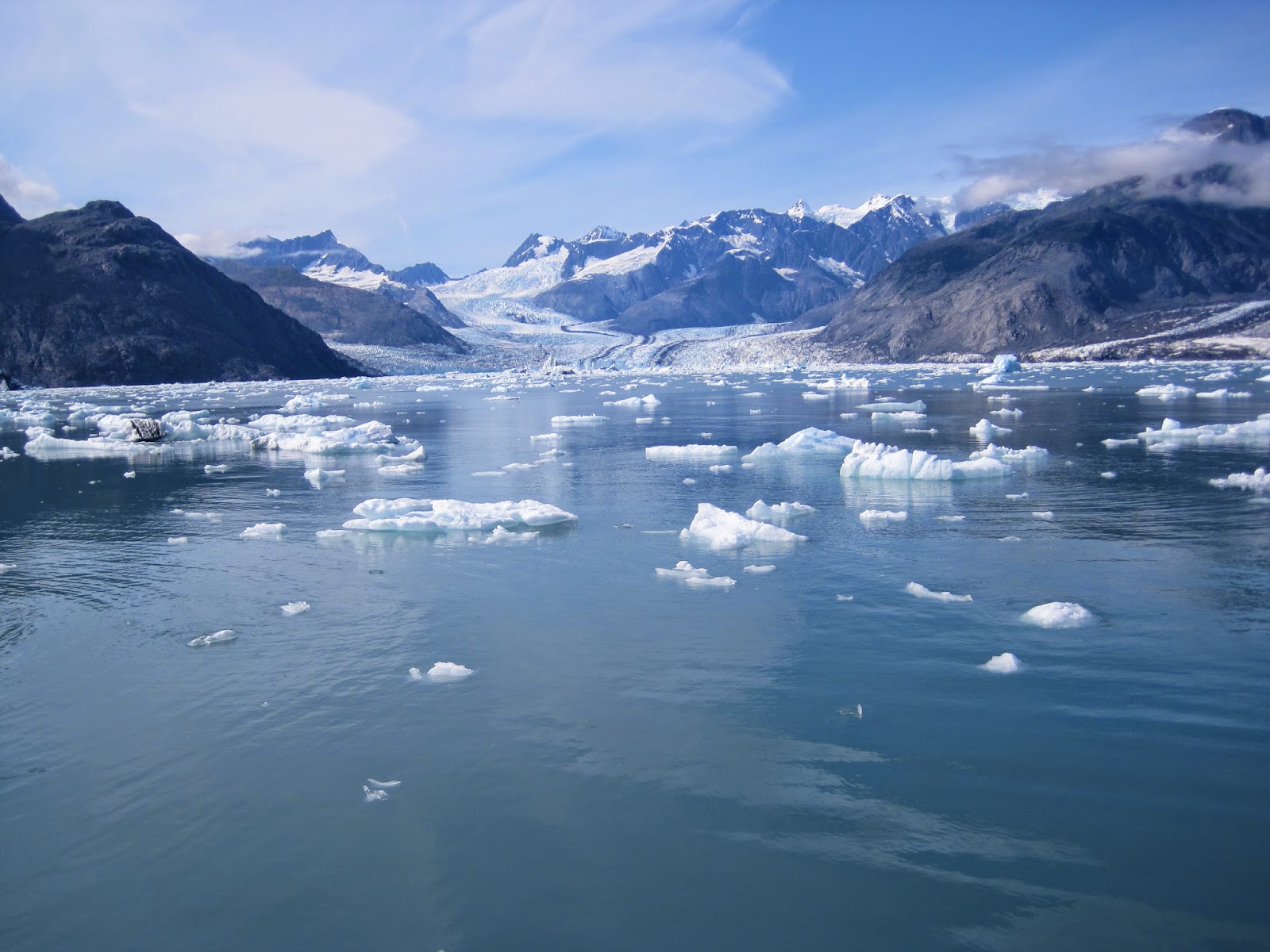
We went down again the next day and joined a cruise of Prince William Sound to the Columbia Glacier. WOW! Photos don’t do it justice but it was a day we will always remember J

We saw sea otters, sea lions, puffins, a breaching humpback whale and waterfalls:


More spectacularly, we saw the Columbia Glacier. The face is 300ft above the waterline and at least 600ft below (the captains sounding equipment only went to 600ft) and this face was 5 miles wide – it was massive!


To give some perspective, the black speck in the following photo is another boat with a 30ft mast!


We heard the glacier creak and groan and were lucky enough to see it calving – where bits fall off. It has retreated 10 miles since the late 1980’s.

The trip there and back was just as amazing as the boat slowly made its way through the ice


From Glenallen to Anchorage, the views were great again:


(we think the poles are to give the snow-ploughs some perspective of how deep the snow is)


We’re now in Anchorage for a few days for a look around and will probably do a day trip down to the Kenai Peninsula – only a 5 hour drive each way!

Thursday, 21 August 2014

Sea level ski resort

‎Sat in the sun by the boat harbour in valdez it feels just like a ski resort, maybe because the glaciers come down to sea level. Stunni

Tuesday, 19 August 2014

Mad Max, the toad warrior


Everyone we have spoken to about the trip to Alaska warned us that the roads were bad, especially the roadworks, and that Alaska does a roaring trade in expensive replacement windscreens for towed vehicles. As we lost our first windscreen cover to crosswinds in west Texas, I spent some of my time in Edmonton on a version 2.0, which secures all the way down the sides and base where it tucks under the doors and bonnet, and this time reinforced it with lexan rather than just sunshade foil. It's stayed on for the last 1750 miles and the windscreen is still intact. Result.

After the first day on the Alaska highway we were picking stones off the roof of the car, and had collected quite a few little chips in the front of the bonnet, so I invested 20 bucks in a sheet of corrugated construction plastic and made some plywood brackets to protect the nose. Seems to work - there are lots of puncture marks in the front of the plastic sheet but our headlights are intact and the paintwork doesn't seem to have suffered any further. Bonus.

After the infamous Top Of The World Highway from Dawson City, which is mostly unpaved, into Alaska in the rain and cloud, the dirt does a wonderful job of sticking to the wet and forming a nice crust over everything, as above. The car is actually dark blue under all that crap. I did think of painting the front up to look like a hockey mask (we were in Canada, after all), but seeing how it ends up there is probably little point. All in all, time and effort well spent.

We had no problems getting back into the US at the Alaska border - we knew in theory that with our 10 year visas we should be OK doing a new entry from Canada - but its a relief that it worked in practice. And to prove the point, the rental RV that tried to come through the border behind us was turned back as they had outstayed their 90 day visa waiver program entry and so were not allowed to re-enter the US....bummer for them, smugness for us.

We now have 2-3 weeks to bum around Alaska before heading back to Canada and down towards Vancouver before it starts snowing...

Friday, 15 August 2014

Right turn Clyde...


And so our journey begins. From Hinton, it was 470km to Dawson Creek and the start of the Alaska Highway


The road was built in 1942 after the bombing of Pearl Harbour by the Japanese, when invasion of the West Coast of North America seemed imminent. Approximately 11,000 US soldiers descended on sleepy little towns in the north and they completed the pioneer road from Dawson Creek to Delta Junction in Alaska, a distance of 1,523 miles, in just over 8 months. This is what the sat nav showed for our journey from Dawson Creek to the turning for Fairbanks:


The longest single stretch of road so far had been across the Nullabor at 1,168kms from South Australia to Western Australia!

From Fort Nelson the scenery was spectacular. Summit Pass and the lake is the highest point on the Alaska Highway at 1,269m


And Muncho Lake is the lowest and also one of the most beautiful 


Along the way we stopped at Liard Hot Springs provincial park and had another bath. It was 30C that day and the hot pool was showing 52C! A bit too warm and I could only stand it for about 5 minutes, so we went into the lower pond and swam to the end where we found the start of the cool stream:


Riding shotgun means I get to take lots of photos out of the window but I also need to be on the lookout for hazards on the road. Everything is bigger over here, even the roadkill. We've encountered elk, caribou, moose


Big horn sheep, bison


and bears, although we were moving too fast to get photos of them!

Watson Lake is the home of the world famous Signpost Forest. In 1942 when the highway was being built, a homesick soldier put up a signpost showing how far he was from home. Since then, 78,000 signposts have been put up by people from all over the world. It really is something to see!


Up and over the Continental Divide and into Whitehorse, the capital of the Yukon Territory,. Of the 36,000 people in the territory (bearing in mind it is over 483,000 square kilometres), 28,000 live here. They reckon there are twice as many moose as people in the Yukon.

We're about half way now and have covered about 1,900km since we left Hinton. Tomorrow we head towards Dawson City...